Services » 3D SCANNING & BIM
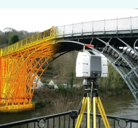
3D Laser scanning enables the collection of a large amount of highly accurate data in a short span of time. RDA offers 3D laser scanning services where we measure up to 1 million points per second to millimeter accuracy. By using the latest scanners and advanced tools, we carry out multiple laser scans from different locations to generate an accurate model of your infrastructure.
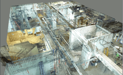
Point cloud survey involves taking multiple scans of the same areas from different angles. The raw data files collected from scanners needs to be processed to be converted into a point cloud file, which is then later used by the companies to create building models in 3D and 2D. RDA offers to register point cloud by using the advanced and right software to streamline the process and help organizations achieve the best results as quickly as possible.
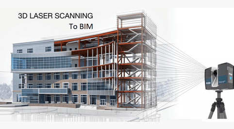
For architects, retailers, and main contractors, RDA offers Scan to BIM 3D modeling services in which we use cutting-edge technology to convert point cloud and laser data into complex 3D BIM models. Engineers, MEP developers, and MEP contractors can benefit from our MEP Scan in BIM consultancy services. The Scan to BIM’s key advantage is the potential to analyze the disparities between point cloud data and model geometry.
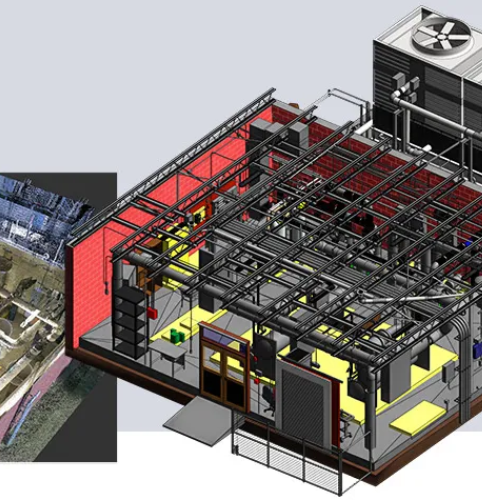
A point cloud is a collection of data points in a three-dimensional coordinate system that depicts an object’s or building’s external surface, including its shape and color. Point cloud data is measured using 2D/3D scanners as a set of vector points, which are subsequently translated into precise parametric REVIT models. Once imported into Revit, we can easily generate a 3D model using the point cloud as a reference by tracing around the point data with our Revit family. Unlike a manual approach, 3D scanned data captures all minute characteristics of the object, avoiding the need for multiple visits to the location.
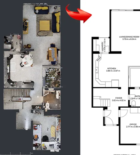
Fresh scanned data of the interiors and exteriors of buildings, topographies, manufactured products, and other objects are used to create point clouds. Following the acquisition of raw data, the data is transformed into usable point cloud files. Cloud point data is collected using 3D laser scanners. It generates precise data that may be quickly transformed into 2D/3D CAD models or CAD drawings. Architects, builders, contractors, and engineers have benefited from our accurate point cloud to 2D CAD conversions.