GPR Utility Surveys
Services » GPR Utility Surveys

RDA Surveys OFFERS
GPR Utility Surveys
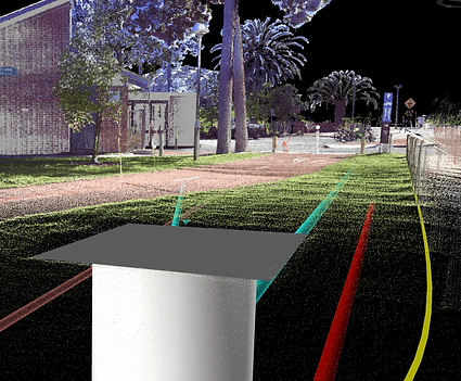
Ground penetrating radar surveys, otherwise known as GPR surveys, have evolved significantly over the last few years and are an essential tool in the box for utility mapping. The technology on its own can be used as a non-intrusive scanning tool to gain imagery from within the ground of your site.
At RDA, we combine GPR technology with total station and GPS devices to conduct surveys with high accuracy for clients throughout Ireland. We utilise the subsurface data which can be collected, positioned, and analysed in both 2D and 3D
Why us?
GPR Survey Applications
GPR surveys can be used to:
- Locate subsurface structures and Utilities
- Obtain subsurface data efficiently for post analysis in normally hard to reach areas such as roads and runways
- Comprehensive 2D and 3D image and drawing reporting.
We are unique in providing GPR services that enable us to create detailed reports and drawings that integrate seamlessly into the client project workflow. We also conduct our GPR surveys in accordance with the PAS128:2014 specification

Providing Complete Solutions
All Services
01.
Scanning
3D Laser
Scanning
Learn more 02.
Mapping
02. GPR Utility
Mapping
Learn more 03.
03. Topographic
Surveys
Learn more 04.
Out
04. Setting
Out
Learn more 05.
Building Surveys
05. Measured
Building Surveys
Learn more 06.
Mapping
